
|
| |||||||||||||||||||

|
Please note that JDLand is no longer being updated.
peek >>
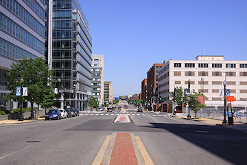
Near Southeast DC Past News Items: M Street
|
See JDLand's M Street Project Page
for Photos, History, and Details |
- Full Neighborhood Development MapThere's a lot more than just the projects listed here. See the complete map of completed, underway, and proposed projects all across the neighborhood.
- What's New This YearA quick look at what's arrived or been announced since the end of the 2018 baseball season.
- Food Options, Now and Coming SoonThere's now plenty of food options in the neighborhood. Click to see what's here, and what's coming.
![-]()
- Anacostia RiverwalkA bridge between Teague and Yards Parks is part of the planned 20-mile Anacostia Riverwalk multi-use trail along the east and west banks of the Anacostia River.
![-]()
- Virginia Ave. Tunnel ExpansionConstruction underway in 2015 to expand the 106-year-old tunnel to allow for a second track and double-height cars. Expected completion 2018.
![-]()
- Rail and Bus Times
Get real time data for the Navy Yard subway, Circulator, Bikeshare, and bus lines, plus additional transit information. - Rail and Bus Times
Get real time data for the Navy Yard subway, Circulator, Bikeshare, and bus lines, plus additional transit information. - Canal ParkThree-block park on the site of the old Washington Canal. Construction begun in spring 2011, opened Nov. 16, 2012.
![-]()
- Nationals Park21-acre site, 41,000-seat ballpark, construction begun May 2006, Opening Day March 30, 2008.
![-]()
- Washington Navy YardHeadquarters of the Naval District Washington, established in 1799.
![-]()
- Yards Park5.5-acre park on the banks of the Anacostia. First phase completed September 2010.
![-]()
- Van Ness Elementary SchoolDC Public School, closed in 2006, but reopening in stages beginning in 2015.
![-]()
- Agora/Whole Foods336-unit apartment building at 800 New Jersey Ave., SE. Construction begun June 2014, move-ins underway early 2018. Whole Foods expected to open in late 2018.
![-]()
- New Douglass BridgeConstruction underway in early 2018 on the replacement for the current South Capitol Street Bridge. Completion expected in 2021.
![-]()
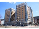
- 1221 Van290-unit residential building with 26,000 sf retail. Underway late 2015, completed early 2018.
- NAB HQ/AvidianNew headquarters for National Association of Broadcasters, along with a 163-unit condo building. Construction underway early 2017.
- Yards/Parcel O Residential ProjectsThe Bower, a 138-unit condo building by PN Hoffman, and The Guild, a 190-unit rental building by Forest City on the southeast corner of 4th and Tingey. Underway fall 2016, delivery 2018.
- New DC Water HQA wrap-around six-story addition to the existing O Street Pumping Station. Construction underway in 2016, with completion in 2018.
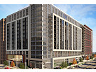
- The Harlow/Square 769N AptsMixed-income rental building with 176 units, including 36 public housing units. Underway early 2017, delivery 2019.
- West Half Residential420-unit project with 65,000 sf retail. Construction underway spring 2017.
![-]()
- Novel South Capitol/2 I St.530ish-unit apartment building in two phases, on old McDonald's site. Construction underway early 2017, completed summer 2019.
![Novel South Capitol]()
- 1250 Half/Envy310 rental units at 1250, 123 condos at Envy, 60,000 square feet of retail. Underway spring 2017.
![-]()
- Parc Riverside Phase II314ish-unit residential building at 1010 Half St., SE, by Toll Bros. Construction underway summer 2017.
![-]()
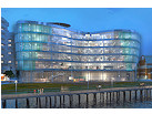
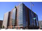
- 99 M StreetA 224,000-square-foot office building by Skanska for the corner of 1st and M. Underway fall 2015, substantially complete summer 2018. Circa and an unnamed sibling restaurant announced tenants.
![-]()
- The Garrett375-unit rental building at 2nd and I with 13,000 sq ft retail. Construction underway late fall 2017.
![-]()
- Yards/The Estate Apts. and Thompson Hotel270-unit rental building and 227-room Thompson Hotel, with 20,000 sq ft retail total. Construction underway fall 2017.
![-]()
- Meridian on First275-unit residential building, by Paradigm. Construction underway early 2018.
![-]()
- The Maren/71 Potomac264-unit residential building with 12,500 sq ft retail, underway spring 2018. Phase 2 of RiverFront on the Anacostia development.
![-]()
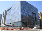
- DC Crossing/Square 696Block bought in 2016 by Tishman Speyer, with plans for 800 apartment units and 44,000 square feet of retail in two phases. Digging underway April 2018.
![DC Crossing]()
- One Hill South Phase 2300ish-unit unnamed sibling building at South Capitol and I. Work underway summer 2018.
![One Hill South Phase 2]()
- New DDOT HQ/250 MNew headquarters for the District Department of Transportation. Underway early 2019.
![New DDOT HQ]()
- 37 L Street Condos11-story, 74-unit condo building west of Half St. Underway early 2019.
![37 L Condos]()
- CSX East Residential/Hotel225ish-unit AC Marriott and two residential buildings planned. Digging underway late summer 2019.
![CSX East Residential/Hotel]()
- 1000 South Capitol Residential224-unit apartment building by Lerner. Underway fall 2019.
![1000 South Capitol Residential]()
- Capper Seniors 2.0Reconstruction of the 160-unit building for low-income seniors that was destroyed by fire in 2018.
![1000 South Capitol Residential]()
- Chemonics HQNew 285,000-sq-ft office building with 14,000 sq ft of retail. Expected delivery 2021.
![1000 South Capitol Residential]()


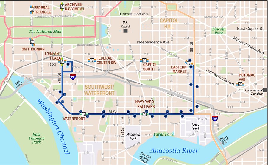 A big change in neighborhood transit arrives today, as the new "Eastern Market-L'Enfant Plaza" (EM-LP) Circulator route begins service. While the new line means riders can no longer take a single bus from Union Station to M Street, or get on/off at 1st and K SE, the tradeoff is a route that connects Near Capitol Ballpark River Yards to the Wharf and then continues up to L'Enfant Plaza. (And then comes all the way back, of course.)
It runs from 6 am to 9 pm on summer weekdays, and 7 am to 9 pm on summer weekends, with hours extended to midnight on days of Nationals home games starting at 6 pm or later.
(As for special routes and service on DC United game days, this is going around Twitter, but I don't see it on the Circulator web site. It would apparently detour down 1st Street SE to Potomac Avenue, then back up Half Street SW.)
As always, rides are $1, with various age-based, transfer-based, and payment type-based discounts.
Meanwhile, on Monday DDOT is "beginning roadway improvements along M Street SE from First Street to 7th Street SE." This will be milling and paving, and will be done between 8 pm and 5 am "to mitigate impact on traffic in this busy corridor." Like on shiny new bus routes!
And now I think it's probably time to head back into tidbit mode, unless big news breaks. Watch the bottom of this post for updates, but here's two tidbits to start that you might not have seen:
* An interesting article on the new Douglass Bridge's design and planned construction from an engineering standpoint.
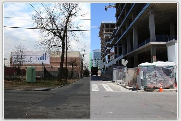
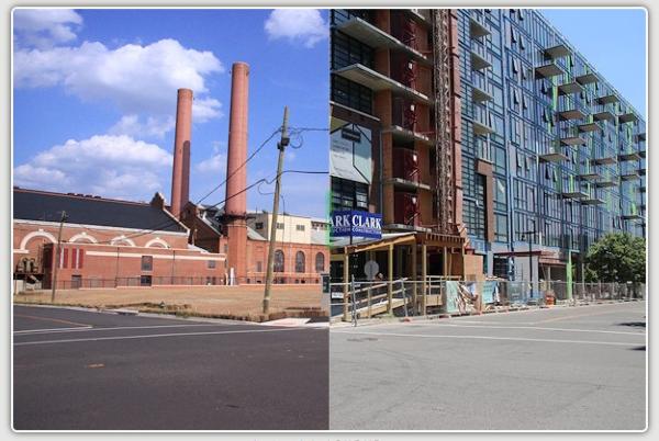
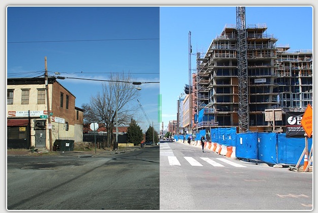
* With all of those photos I took last week, it was time to update the Sliders, and I also took the opportunity to add a bunch of new angles to the Slider lineup. I can't embed them here, but here are screenshots that you can click on to see the sliding in action. Or you can scroll down through all 35 sliders that I updated/added, as well as browse the full archive.
|
Comments (17)
|
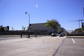
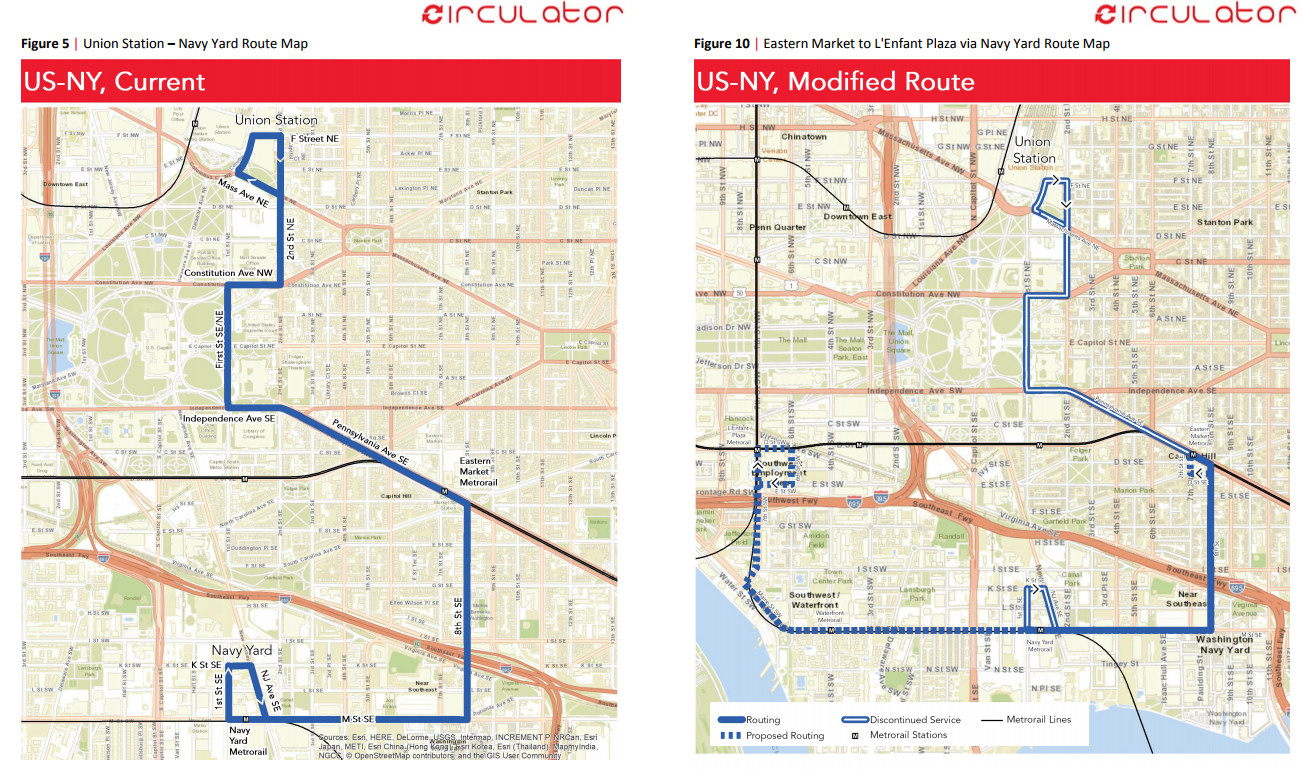 On Thursday DDOT released its 2017 Transit Development Plan, and amongst the torrent of words are proposals for a number of Circulator changes, including the long-discussed extension of the current Navy Yard route that would continue along M Street SW and the southern portion of Maine Avenue and up 7th Street SW to the L'Enfant Plaza Metro station, but would discontinue the portion of the route between Union Station and Eastern Market. (The double lines in the right-hand map are the "discontinued service" portions.)
 There would also be year-round weekend service, from 7 am to 9 pm on Saturdays and Sundays.
Circulator service between Union Station, Barracks Row, and the Washington Navy Yard (the actual, living, breathing, functioning "Navy Yard") would be available on a reconfigured version of the Potomac Avenue-Skyland route (see page 52 of the report for a map).
The report also says that "a special standalone service plan will be developed to provide DC Circulator service to the new DC United Soccer Stadium before, during, and after games."
These changes aren't final--there is now a public comment period, through Jan. 19, 2018, and there will be a public hearing on Thursday, Jan. 4, 2018, from 7 to 9 pm at the Miracle Theatre at 535 8th St., SE.
But DDOT says that it expects that the changes would be implemented in April, 2018.
|
Comments (34)
|
 If you are looking for some light Christmas reading, you can sit down by the fireplace with all 335 pages (plus appendices!) of the newest revision to the plans for reconfiguring much of South Capitol Street, including the construction of a new Frederick Douglass Bridge.
This document, technically known as the Supplemental Draft Environmental Impact Statement (SDEIS), describes the new "revised preferred alternative" (RPA) design that tweaks the original preferred alternative in the Final EIS released back in 2011.
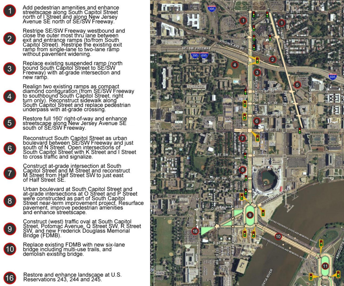
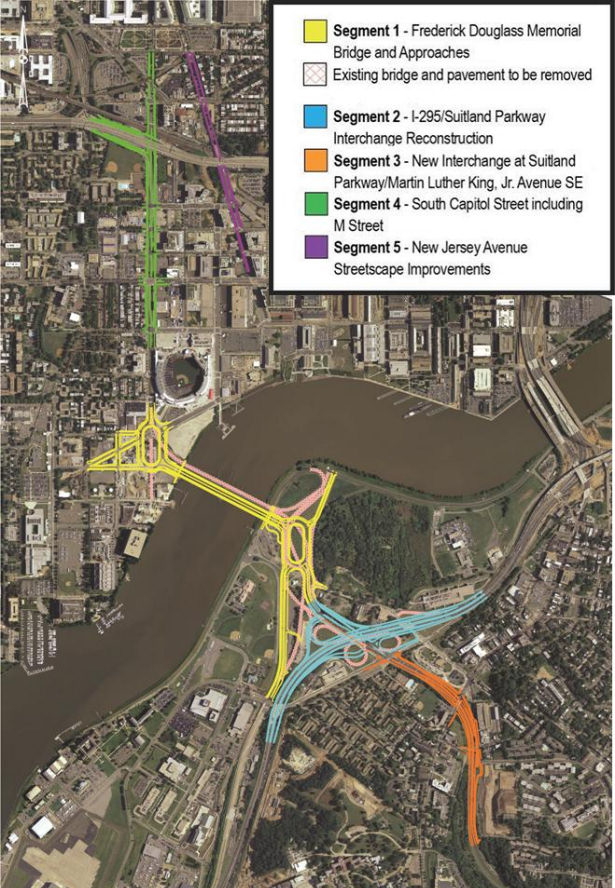
The bullet points for what the project plans are north/west of the Anacostia River are in the graphic at right (click to enlarge). The changes in this new RPA include:
* Changing the design of the bridge from a moveable span to a fixed-span bridge, which would save approximately $140 million in construction costs;
* Shifting the orientation of the new Douglass Bridge to an alignment parallel to the existing bridge, 30 feet down river, which avoids the need and lengthy process to acquire some land from Joint Base Anacostia-Bolling as well as a number of expensive relocation and reconstruction issues that a new alignment avoids (see page 2-91 of the SDEIS for details);
* A slight reduction of the size of the traffic oval on the western side (at Potomac Avenue):
* Replacing the previously designed circle on the eastern approach with an oval, located entirely in the DDOT right-of-way;
* And several other changes on the east side of the project that I will leave to others to discuss in detail. (See page ES-6 of the SDEIS.)
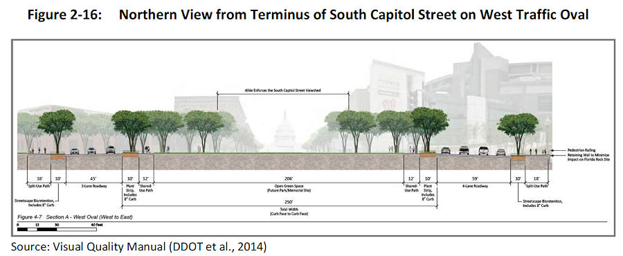 The initial design of the ovals and of the bridge itself were met with some consternation during this revision process. The SDEIS notes that in response to these concerns, DDOT has created a "Visual Quality Manual" for the project, which identifies design goals that are to "reflect the vision of providing a grand urban boulevard, which will be a gateway into the nation's capital, an iconic symbol of the District's aspirations in the 21st century, and a catalyst to revitalize local neighborhoods and the Anacostia Waterfront." (page 2-26).
  As for the bridge itself, the version in this RPA will support three travel lanes in each direction, along with 18 feet of bicycle and pedestrian paths on *both* sides of the bridge--an 8-foot lane for pedestrians and a 10-foot birdirectional bike path. (Enlarge the image at right to see that I'm not lying about the bike/ped stuff.)
And the design of the bridge is to "make its primary aesthetic impact through its position (alignment), and the shape and sizes of its structural elements" and is to " aesthetically appear to be part of a continuous urban corridor." This includes the avoidance of "using elements, solely for aesthetic effect, which do not contribute to the support of the bridge." (page 2-28)
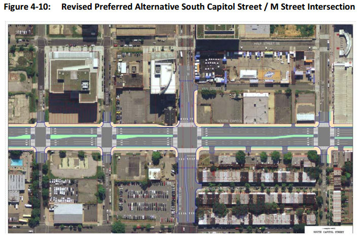
Plans for the reconfiguration of South Capitol Street as a "grand urban boulevard" have all along called for changing the intersection of South Capitol and M streets to an "at-grade intersection" (page 4-79), which would also mean that K and L would have signalized four-way intersections with South Capitol, unlike today. The wide median seen south of N would be established on the north end of the street as well, now all the way to D Street SE in the RPA. Also changing in this new plan are a few new left-turn options at I Street SE/SW and L Street SE.
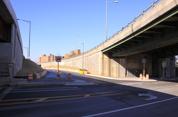
 Revisions have also been made to the ramps from South Capitol Street to I-395 and I-695, but the basics from the original plans remain, most notably the demolition of the existing suspended ramp from northbound South Capitol to the SE/SW Freeway.
Even with the revisions made to cut the costs of the new Douglass Bridge, this isn't a cheap project. The five phases together are anticipated to cost over $1 billion, with Segment 1, including the new bridge and traffic ovals, estimated at $480 million. The "grand boulevard"-izing of South Capitol Street is estimated at $153 million, and planned streetscape improvements to New Jersey Avenue between D and M streets SE at $42 million, plus another $358 million in east-of-the-river improvements (page 2-11).
Worn out yet? I sure am! (I've mostly lost track of how much of this is truly even "new" news at this point.) But perhaps you can regain your strength by Jan. 22, 2015, when the public meeting on this SDEIS will be held from 6:30 to 8:30 pm at Matthews Memorial Baptist Church Fellowship Hall, 2616 Martin Luther King Ave., SE. The public comment period is running until Feb. 2. DDOT is also still amidst the design/build proposal process, with proposals expected sometime in the spring.
The SouthCapitolEIS.com web site is now focused mainly on this SDEIS, of which clearly I've just scratched the surface; you can slog through my piles of posts on all of this over the years for the historical rundown.
UPDATE: Here's the WashCycle take on the latest plans, from a bike/ped perspective.
|
Comments (5)
More posts:
Pedestrian/Cycling Issues, meetings, M Street, South Capitol St., Douglass Bridge, Traffic Issues
|
The DC police department reports that on Wednesday afternoon at approximately 4 pm its officers responded to a report of an armed carjacking. Then, as described on the MPD-1D mailing list, "During a canvass in the area, the suspect was apprehended in the 1000 Block of M St., S.E. after he was involved in a traffic accident. The suspect was positively identified and placed under arrest for Armed Carjacking and Carrying a Pistol." The eastern blocks of M between 9th and 11th were closed for a few hours during the investigation.
Did anybody see any of this transpire?
UPDATE, 7/3: This morning's daily crime report on the 1D mailing list seems to say that the carjacking actually happened in front of the Jefferson/Axiom buildings at 70/100 I St. SE. I've written asking for confirmation as to whether this is indeed the same case. I'll post the differing police reports in the comments.
 I already wrote about how this Saturday, June 21, is the target date for DDOT to open the new ramp from eastbound I-695 to 11th Street, SE. (Yay!)
But now there's a related closing to note: On June 21, DDOT will close the newish on-ramp from 11th Street SE to the westbound Southeast Freeway for two months, until approximately August 23.
This will allow the completion of the rebuilt exit to I Street from inbound I-695, which has been closed while the old flyover has been demolished.
If you're needing to get on the westbound freeway, you'll need to use the ramp at 3rd Street and Virginia Avenue, or the South Capitol Street ramp. (Or I guess you could go backwards and get on southbound DC-295 at Pennsylvania Avenue and take the Capitol Hill exit.)
Here's DDOT's advisory on that closing if you want to know more, or to see the pretty graphic with all the detour arrows.
 Meanwhile, the icky configuration of the eastern section of M Street thanks to DC Water's Clean Rivers Project is about to get ickier: Starting on or about Wednesday, June 18, through the end of the year, two eastbound M Street lanes between 7th and 11th Streets, SE will be closed 24/7, leaving two lanes of eastbound and two lanes of westbound traffic on M. Best to also expect some stoppages of traffic during the work hours of 7 am to 7 pm Monday through Saturday.
You can read the DC Water advisory on the closure for more information.
|
Comments (3)
More posts:
11th Street Bridges, M Street, Traffic Issues
|
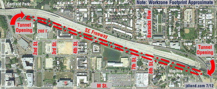
* CSX NEAR: The Kojo Nnamdi Show hosted on Monday a roundtable on the Virginia Avenue Tunnel project, with David Garber and others. You can listen to it here.
* CSX FAR: Heads will explode, but I will pass along that CSX's J&L Tunnel Modification project has recently won two engineering awards. What is this tunnel? "The J&L Tunnel was constructed in the 1880s as part of the Pittsburgh & Lake Erie Railroad to allow trains to run beneath the former J&L Steel Company’s Pittsburgh Works Southside facility." And what was the project? CSX "increased the vertical clearance of a 130-year-old tunnel running through Pittsburgh’s SouthSide Works, a mixed-use residential and commercial development. CSX worked closely with public officials, local businesses and residents to minimize noise and disruption during construction. Upon completion of the tunnel work, CSX restored trees and plantings, and invested in landscaping improvements that left the overlying Tunnel Park a more usable recreational space."
* HAMPTON: The building permit has been approved for the 168-room Hampton Inn just north of Nats Park. (The shoring permit was approved back in December.)
* THE MASTER PLAN: DDOT has officially released its update to the Anacostia Waterfront Initiative Master Plan. This covers projects like the new Douglass Bridge and South Capitol Street makeover, the Barney Circle/Southeast Boulevard redo, the M Street SE/SW transportation study, the Anacostia Riverwalk Trail, and all other manner of projects and studies for infrastructure updates and improvements in the area. (Though, at 194 pages, maybe the Executive Summary will be a good place to start.) If I were a good blogger, I'd write a big in-depth entry about this, but, well, we know the answer to that these days....
* POLITICS: The Post grades the recent Southwest/Near Southeast Mayoral Forum, and the Hill Rag looks closely at the Ward 6 council race. Primary day is now less than a month away, on April 1. And note that tonight (March 4) there is a forum with the candiates at 7 pm at Westminster Church at 400 I St. SW, and there will be a Ward 6 candidate forum on education issues on Thursday, March 6, at 6:30 pm at Stuart-Hobson Middle School.
* DE-W'ED: Have you noticed that the Curly Ws are gone from various freeway signs? Here's why.
* PASTOR MILLS: Unfortunately, a sad piece of news to mention is that Karen Mills, pastor of the St. Paul's church at 4th and I SE, passed away on Feb. 21. I only met her a few times, but she was a very welcoming and pleasant presence, and condolences go out to her family, friends, and members of the church.
Anything else catching peoples' eyes?
|
Comments (8)
More posts:
CSX/Virginia Ave. Tunnel, hamptoninn, M Street, politics, Southeast Blvd., South Capitol St., Douglass Bridge, Traffic Issues
|
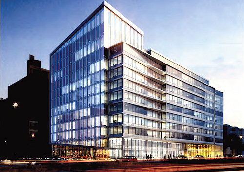
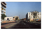
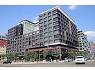
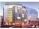
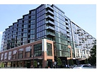
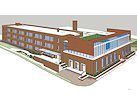
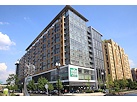
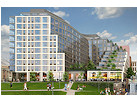
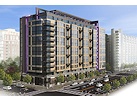
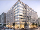
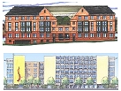
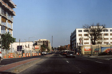
On January 17, the Zoning Commission will be taking up a Capitol Gateway Overlay Review request from Monument Realty for "One M Street," an approximately 328,000-square-foot office building planned for the southeast corner of South Capitol and M streets, SE, on what old-timers know as the old Domino's site, just to the north of the self-storage building.
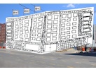
The building, which is referred to in the zoning submittals as a speculative development, would have a large lobby entrance at the corner of South Capitol and M and somewhere between 9,000 and 17,260 square feet of ground-floor retail, plus four floors of underground parking with 310 spaces. It would be 12 stories high along M Street, but as seen in the above rendering grabbed from the documents, the height along South Capitol would be lower, because of the "different characters" of the two streets. You can see another rendering of the building, as seen from M Street at Van, here.
This has also been referred to the National Capital Planning Commission for review, and ANC 6D will of course be getting a crack at it as well. There's no estimated timeline mentioned in the zoning documents. (But we know how I feel about "estimated" start dates these days anyway. Show me a shovel in the ground!)
Monument has owned the Domino's parcel on the corner since 2005, and added the L-shaped parcel to its east and south in 2008 as part of its settlement with WMATA over not getting the Southeastern Bus Garage site just to the east. Monument, as most people know, built quite a portfolio of land in the blocks just to the north of Nationals Park in 2004 and 2005, having completed 55 M Street in 2009 and still controlling the rest of the land on the east side of Half Street, along with the old Sunoco site on the northeast corner of Half and M and the old BP/Amoco site on the northeast corner of South Capitol and N.
|
Comments (1)
|
It's summer, and I'm trying to be on a Word Diet, so lots of links, but short and sweet:
* This week's Front Flick, O Brother, Where Art Thou?, tonight at Tingey Plaza.
* Another installment of Truckeroo on Friday.
* One potential candidate for Near Southeast's two ANC single member districts has already picked up nominating petitions: Ed Kaminski, who lives in 6D02.
* Washington Examiner is hot on the Hood. Times two. Shorter version: more people coming (like Nats fans). More stuff coming. But you knew this already.
* Miniature golfing in Canal Park, in a manner of speaking.
* Reunion of Arthur Capper residents last week at Garfield Park.
* There's now lane restrictions on M Street SE between 7th and 11th for the next, oh, 27 months or so, thanks to the DC Water Clean Rivers Project. (This is also why Water Street east of 12th Street is closed.) The work along M got off to a bit of a rough start last month when contractors took over the pocket park at 8th and Potomac without using a particularly light touch.
* Nats Park in the mix for the 2015 MLB All-Star game, but lots of other cities want it, too.
* Across the way: new DC United investors "should boost quest for stadium" at Buzzard Point.
* At least SOME major media organizations know how to credit scoops. {Said while glaring at WashBizJ, though not PhilBizJ}
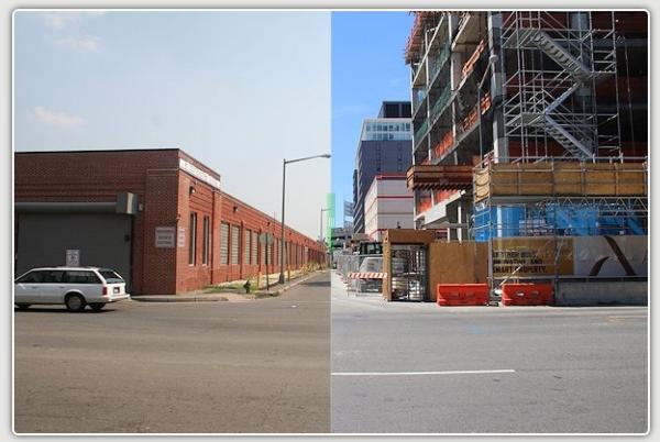
* Folks at 909 New Jersey, and also 1980s DC nightclubbers, might like this WaPo photo. Especially when compared to this. (The railroad tracks are probably not missed.)
|
Comments (0)
More posts:
ANC News, Fairgrounds/Bullpen, Canal Park, Capper, Events, M Street, Nationals Park, truckeroo, DC Water (WASA)
|
To allow you to properly plan your calendar for the week, I'm posting this nice and early:
* Virginia Avenue Tunnel: Monday night is another public meeting on the planned Virginia Avenue Tunnel reconstruction, at which it's expected that DDOT, FHWA, and CSX will be presenting the concepts that have been chosen from the original batch to study in detail as part of the project's EIS. The meeting is at Nationals Park at 6 pm.
And, speaking of the tunnel, the noise and vibration field studies required as part of the EIS will be happening this week. (But no fair stomping on the ground and gunning your car's engines for hours at a time.)
* M Street SE/SW Transportation Study: The meeting to update the public on the progress of the M Street SE/SW Transportation Study is on Thursday, May 24, from 6:30 pm to 8 pm at the Capitol Skyline Hotel, 10 I St. SW. The study area covers the stretch of M from 12th Street, SE to 14th Street, SW, along with the adjacent areas from the Southeast/Southwest Freeway south to the Anacostia River/Washington Channel. DDOT is looking at "how to integrate transit, bicycling and walking with motor vehicle traffic," while also trying to figure out how to balance residents' preferences for how M Street should be configured versus how visitors, workers, and commuters expect it to flow. The first meeting was in January, and the final report is expected in the fall.
* Front Flicks: If you are looking for something slightly more entertaining than either of the week's meetings, don't forget that the Capitol Riverfront BID's free Front Flicks Summer Outdoor Movie Series begins this week on Thursday, with "Lara Croft: Tomb Raider" leading off the lineup of treasure hunt-themed offerings. Movies start either at 8:45 pm/sundown at Tingey Plaza, just behind USDOT at New Jersey and Tingey.
Alas, I won't be at any of these events, because first thing Tuesday I'm headed to the disabled list, to get some health issues dealt with that have been dragging me down for awhile now. There will be a few weeks of recovery time, so I ask all parties to please refrain from making any news before, say, mid-June, or at least make it something simple and/or something that won't require my attendance. (DDOT is already On Notice if they do indeed partially open the 11th Street Local bridge when I can't document it.)
I imagine I'll reappear on Twitter fairly quickly, since I know better than to think I can stay off the Internet while I'm doing little but laying around. But most likely the bulk of my narcotics-tinged/boredom-induced missives will be via my non-official @jacdupree account, if you want the entertainment.
In the meantime, feel free to use this post's comments to discuss this week's meetings and as a general open thread, but I will be watching and popping in, so don't you kids think you can throw a wild party while Mom's not looking! And hopefully I'll be back to photo taking and other obsessive-compulsive pursuits before too long.
|
Comments (3)
More posts:
Pedestrian/Cycling Issues, CSX/Virginia Ave. Tunnel, Events, meetings, M Street, JDLand stuff, Traffic Issues
|
DDOT has announced that a meeting to update the public on the progress of the M Street SE/SW Transportation Study has been scheduled for May 24, from 6:30 pm to 8 pm at the Capitol Skyline Hotel, 10 I St. SW.
The study area covers the stretch of M from 12th Street, SE to 14th Street, SW, along with the adjacent areas from the Southeast/Southwest Freeway south to the Anacostia River/Washington Channel. DDOT is looking at "how to integrate transit, bicycling and walking with motor vehicle traffic," while also trying to figure out how to balance residents' preferences for how M Street should be configured versus how visitors, workers, and commuters expect it to flow.
The first meeting, back in January, included an introduction to the study before attendees broke up into small groups to give feedback about the issues they feel need addressing.
According to the web site, a draft study report is expected this summer, with the final report and a final public meeting coming in the fall.
|
Comments (1)
|