
|
| |||||||||||||||||||

|
Please note that JDLand is no longer being updated.
peek >>
Near Southeast DC Past News Items: Rearview Mirror
- Full Neighborhood Development MapThere's a lot more than just the projects listed here. See the complete map of completed, underway, and proposed projects all across the neighborhood.
- What's New This YearA quick look at what's arrived or been announced since the end of the 2018 baseball season.
- Food Options, Now and Coming SoonThere's now plenty of food options in the neighborhood. Click to see what's here, and what's coming.
![-]()
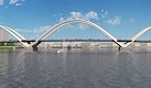
- Anacostia RiverwalkA bridge between Teague and Yards Parks is part of the planned 20-mile Anacostia Riverwalk multi-use trail along the east and west banks of the Anacostia River.
![-]()
- Virginia Ave. Tunnel ExpansionConstruction underway in 2015 to expand the 106-year-old tunnel to allow for a second track and double-height cars. Expected completion 2018.
![-]()
- Rail and Bus Times
Get real time data for the Navy Yard subway, Circulator, Bikeshare, and bus lines, plus additional transit information. - Rail and Bus Times
Get real time data for the Navy Yard subway, Circulator, Bikeshare, and bus lines, plus additional transit information. - Canal ParkThree-block park on the site of the old Washington Canal. Construction begun in spring 2011, opened Nov. 16, 2012.
![-]()
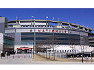
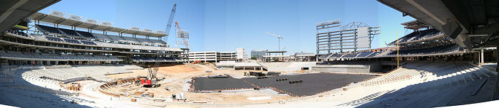
- Nationals Park21-acre site, 41,000-seat ballpark, construction begun May 2006, Opening Day March 30, 2008.
![-]()
- Washington Navy YardHeadquarters of the Naval District Washington, established in 1799.
![-]()
- Yards Park5.5-acre park on the banks of the Anacostia. First phase completed September 2010.
![-]()
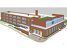
- Van Ness Elementary SchoolDC Public School, closed in 2006, but reopening in stages beginning in 2015.
![-]()
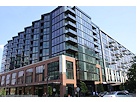
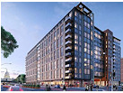
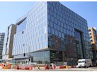
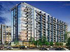
- Agora/Whole Foods336-unit apartment building at 800 New Jersey Ave., SE. Construction begun June 2014, move-ins underway early 2018. Whole Foods expected to open in late 2018.
![-]()
- New Douglass BridgeConstruction underway in early 2018 on the replacement for the current South Capitol Street Bridge. Completion expected in 2021.
![-]()
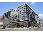
- 1221 Van290-unit residential building with 26,000 sf retail. Underway late 2015, completed early 2018.
- NAB HQ/AvidianNew headquarters for National Association of Broadcasters, along with a 163-unit condo building. Construction underway early 2017.
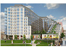
- Yards/Parcel O Residential ProjectsThe Bower, a 138-unit condo building by PN Hoffman, and The Guild, a 190-unit rental building by Forest City on the southeast corner of 4th and Tingey. Underway fall 2016, delivery 2018.
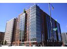
- New DC Water HQA wrap-around six-story addition to the existing O Street Pumping Station. Construction underway in 2016, with completion in 2018.
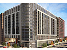
- The Harlow/Square 769N AptsMixed-income rental building with 176 units, including 36 public housing units. Underway early 2017, delivery 2019.
- West Half Residential420-unit project with 65,000 sf retail. Construction underway spring 2017.
![-]()
- Novel South Capitol/2 I St.530ish-unit apartment building in two phases, on old McDonald's site. Construction underway early 2017, completed summer 2019.
![Novel South Capitol]()
- 1250 Half/Envy310 rental units at 1250, 123 condos at Envy, 60,000 square feet of retail. Underway spring 2017.
![-]()
- Parc Riverside Phase II314ish-unit residential building at 1010 Half St., SE, by Toll Bros. Construction underway summer 2017.
![-]()
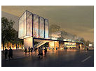
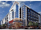
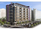
- 99 M StreetA 224,000-square-foot office building by Skanska for the corner of 1st and M. Underway fall 2015, substantially complete summer 2018. Circa and an unnamed sibling restaurant announced tenants.
![-]()
- The Garrett375-unit rental building at 2nd and I with 13,000 sq ft retail. Construction underway late fall 2017.
![-]()
- Yards/The Estate Apts. and Thompson Hotel270-unit rental building and 227-room Thompson Hotel, with 20,000 sq ft retail total. Construction underway fall 2017.
![-]()
- Meridian on First275-unit residential building, by Paradigm. Construction underway early 2018.
![-]()
- The Maren/71 Potomac264-unit residential building with 12,500 sq ft retail, underway spring 2018. Phase 2 of RiverFront on the Anacostia development.
![-]()
- DC Crossing/Square 696Block bought in 2016 by Tishman Speyer, with plans for 800 apartment units and 44,000 square feet of retail in two phases. Digging underway April 2018.
![DC Crossing]()
- One Hill South Phase 2300ish-unit unnamed sibling building at South Capitol and I. Work underway summer 2018.
![One Hill South Phase 2]()
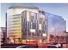
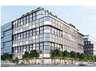
- New DDOT HQ/250 MNew headquarters for the District Department of Transportation. Underway early 2019.
![New DDOT HQ]()
- 37 L Street Condos11-story, 74-unit condo building west of Half St. Underway early 2019.
![37 L Condos]()
- CSX East Residential/Hotel225ish-unit AC Marriott and two residential buildings planned. Digging underway late summer 2019.
![CSX East Residential/Hotel]()
- 1000 South Capitol Residential224-unit apartment building by Lerner. Underway fall 2019.
![1000 South Capitol Residential]()
- Capper Seniors 2.0Reconstruction of the 160-unit building for low-income seniors that was destroyed by fire in 2018.
![1000 South Capitol Residential]()
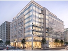
- Chemonics HQNew 285,000-sq-ft office building with 14,000 sq ft of retail. Expected delivery 2021.
![1000 South Capitol Residential]()


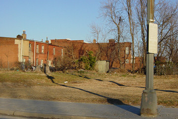
For those who haven't looked northward on New Jersey Avenue lately, may I offer two photos of the view, the first taken in January 2015 and the second this past weekend:

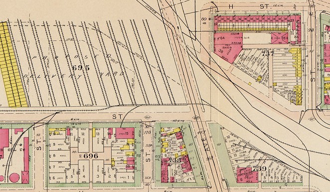 Back so long ago it was even before I was born, the block north of I Street was a massive rail yard, as you can see in this 1939 photo but also in this portion of the 1909 Baist survey map for this area (you'll definitely want to see the enlarged and wider version of this map, as well as others of the neighborhood between 1903 to 1921 that I all but forgot were posted here on JDLand until I was writing this).
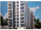
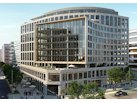
With apologies for wide angle lens images that make the Capitol dome look much smaller than it does in person, it's still plain to see that the construction of 82 I/801 New Jersey/Apartment to Be Named Later has taken a bite out of the "centered" view of the dome that New Jersey Avenue has enjoyed up to now.
The question as to why this project has been able to build so much closer to the curb line than others (which has not only affected the view shed but also caused many pedestrian movement-related issues over the past year) is one that is tied up in the gritty industrial history of that particular block, along with the phrase "by right."
Back so long ago it was even before I was born, the block north of I Street was a massive rail yard, as you can see in this 1939 photo but also in this portion of the 1909 Baist survey map for this area (you'll definitely want to see the enlarged and wider version of this map, as well as others of the neighborhood between 1903 to 1921 that I all but forgot were posted here on JDLand until I was writing this). 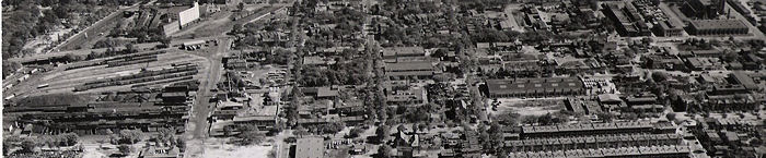
You can also see the footprint remnants of the old Washington Canal running diagonally toward New Jersey from the right side of the image up toward New Jersey and I and Square 695.
What you can also see on that map is the distinct property lines on surrounding blocks, where buildings stop and the official city-owned "right of way" begins, the width of which was based on the width of the street, so that a wide avenue such as New Jersey has a wider ROW than smaller streets nearby.
You can then also see that Square 695 has no extra ROW built in, except for a small portion on the western end.
This block is also not covered by the Capitol Gateway Zoning Overlay, and the design for 82 I fell within the requirements of its C3C zone (i.e., it's a "by right" project), so there were no submittals to the Zoning Commission, no input from the Office of Planning, etc.
And that's why the building is now "jutting" out into New Jersey, and why the excavation for the garage went right up to the curb line, and why the sidewalk won't be anywhere near as wide in this block as in others, though note that the ground floor is set further back from the curb than the stories above it, as seen in this rendering.
But seriously, take some time and browse the old maps.
If you'd like to go back in time this holiday weekend, here are a few options for you.
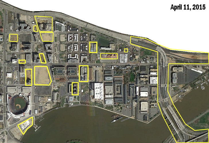 * FROM FAR ABOVE, 2015: With thanks to reader Maelstrom for the heads up, I've added Google's new satellite view of the neighborhood from April 11, 2015 to my Images From Above page, which displays annotated images first from 1949 then every few years from 1988 to the present, showing the changing landscape of Near Southeast.
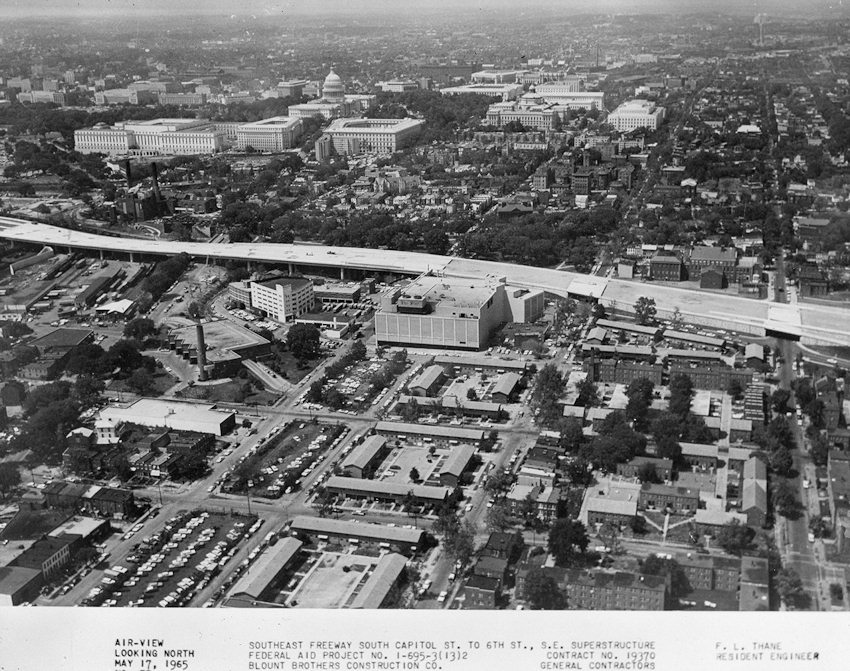
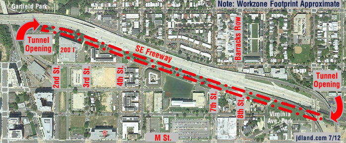
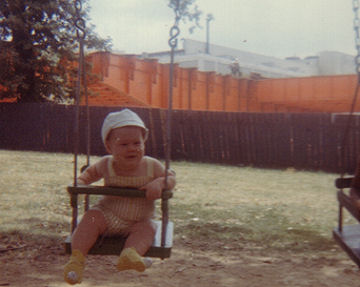 Of course, if you want to see what the construction of the Southeast Freeway looked like from ground level in about 1964, I can once again go to the well to show you this photo of my brother on the swings at Garfield Park, with the new freeway looming (and the former Washington Star building at 225 Virginia, now better known as the renovated 200 I, at rear). There's also the brief snippet of Super 8 film my grandmother took in 1969 from the tennis courts at South Capitol and I, where she panned across the freeway vista. (I'm the one burning rubber on the tricycle.)
* FROM FAR ABOVE, 2015: With thanks to reader Maelstrom for the heads up, I've added Google's new satellite view of the neighborhood from April 11, 2015 to my Images From Above page, which displays annotated images first from 1949 then every few years from 1988 to the present, showing the changing landscape of Near Southeast. This From Above page allows you to choose certain photos to compare, and now you can also click them to pop them up, easily toggling between them for better comparisons. (The new pop-up option also now means I need to do a better job of cropping and matching the photos, but not today.)
This particular shot marks the changes since the October 2012, and there's a pile of them, as you can see by the yellow highlights, since it was taken just as excavation had gotten underway at four sites and work was well underway at quite a few others. (The 2017 image should be a beaut!)
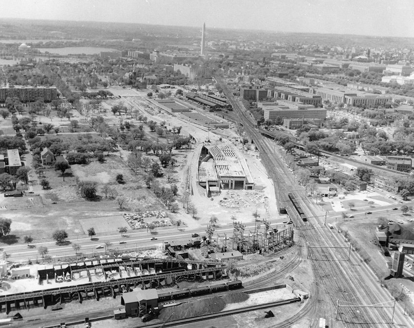
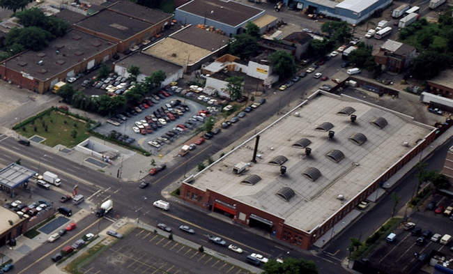
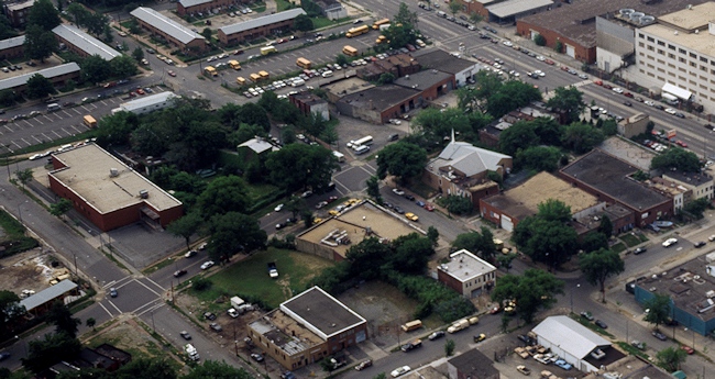
* FROM NEAR ABOVE, 1965: DDOT has a cool Tumblr where they post long-ago photos of the city from their archives, and recently they tossed me a bone with two helicopter (?) shots of the construction of the Southeast/Southwest Freeway taken in 1965, one of which shows the northern portion of Near Southeast, including the building on the site where the Park Chelsea and 800 New Jersey are being built, that I looked at for years from the freeway but never took my own photos of before it was demolished around 2000. (WAAAAAH) I hope they don't mind my reproducing them here, and adding them to my Historic Photos page.
Of course, if you want to see what the construction of the Southeast Freeway looked like from ground level in about 1964, I can once again go to the well to show you this photo of my brother on the swings at Garfield Park, with the new freeway looming (and the former Washington Star building at 225 Virginia, now better known as the renovated 200 I, at rear). There's also the brief snippet of Super 8 film my grandmother took in 1969 from the tennis courts at South Capitol and I, where she panned across the freeway vista. (I'm the one burning rubber on the tricycle.)And if that makes you want even more of a peek into the past , I can again point you to the series of posts my dad wrote for JDLand of what life on the Hill was like in the 1960s, with more photos and home movies.
|
Comments (5)
More posts:
Rearview Mirror
|
I've been across the pond for the past two weeks, and did a fine job of ignoring the many news items that came through the pipeline while I was gone. I'll be catching up over the next few days with a slew of posts (accompanied with a whole lot of new photos), so be prepared for the onslaught. 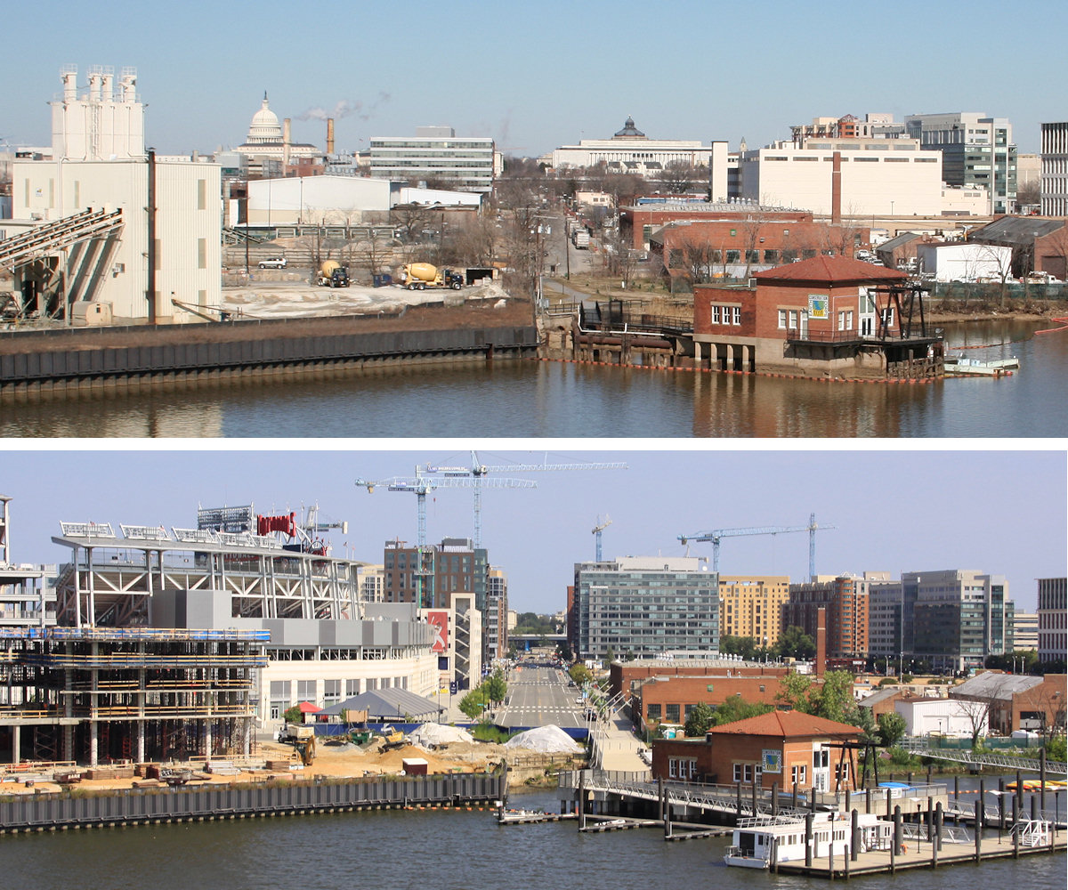
But, while I'm working on them, here's a little brain teaser, like you'd see in the Sunday comics, for the 12 of you who still know what a "newspaper" is:
(click to enlarge)
The top photo was taken from the Douglass Bridge in February 2006, and the bottom one on Saturday, just a smidge over 9 1/2 years later, and I count 14 differences (combining "x building demolished, y building now in its place" into single items). Do you see them all? And no, cranes don't count.
|
Comments (3)
More posts:
Rearview Mirror
|
 Today marks what was probably the biggest event in the neighborhood until the Nationals moved to South Capitol Street: It was 200 years ago, on Aug. 24, 1814, that US troops burned the Washington Navy Yard to prevent it from falling into the hands of the advancing British forces during the War of 1812.
The US Naval Institute blog gives a rundown of the day in the form of a photo tour of current structures and locations inside the walls.* And the Post has a big piece on this part of the War of 1812 all around Washington. (Makes you wish the Anacostia RIverwalk Trail had been completed to Bladensburg by today.)
There are a number of events at the Navy Yard today to commemorate the day as I mentioned earlier this week, including a new exhibit at the National Museum of the United States Navy called "Defeat to Victory: 1814-1815," along with family activities from 12 to 4 pm, music by the Chanteymen, and gun demonstrations at the still-docked Pride of Baltimore at 1:15 and 3:15 pm.
Note that on weekends, access to the Navy Yard by visitors is via the gate at 6th and M, SE, and a government photo ID is required to enter.
* And the events of this day 200 years ago had a much longer-lasting effect on the neighborhood than people may realize. Quoting from the Naval Institute Blog:
"But what likely burned the backside of the Yard's commander, Commodore Thomas Tingey, even more was the discovery upon his return Aug. 26 that his house on the compound (known then as Quarters A, and known today as Tingey House, home of the Chief of Naval Operations) had been thoroughly looted and stripped of all hardware as well as doors and windows... not by the invading Brits, but rather by his D.C. neighbors outside the then short, wooden fence that marked and obviously inadequately protected the base's perimeter.
"Shortly thereafter Tingey ordered the fence around the Navy Yard to be fortified and increased in height to 10 feet."
History is in the air this week!
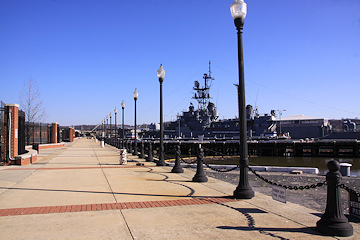
* SHIP DOCKING: The Pride of Baltimore II, a reproduction of an 1812-era topsail schooner privateer that bills itself "America's Star-Spangled Ambassador," will be docking at the Navy Yard from Wednesday, Aug. 20 through Monday, Aug. 25. Free public tours will be available from 1 pm to 4 pm each day.
In conjunction with the Pride's arrival, the U.S. Navy Museum is holding several events on Sunday, Aug. 24, including riverwalk cannon salutes at 1:15 and 3:15 pm. There will also programs in and around the Museum that day, including performances by the Chanteymen and more. (I'd link to a web page with details on the museum's offerings on Sunday, but can't find one anywhere.) Going to the Navy Museum requires entry at the O Street Gate on 11th Street, SE.
(And, on a side note, because I know people will ask, the Douglass Bridge will be closed to vehicle traffic from 2 am to 5 am late tonight/tomorrow morning to "allow water traffic to pass." Not a stretch to guess that these are related items.)
* SHINER LECTURE: Did you know that a slave named Michael Shiner, born in 1813, kept a diary of life in and around the Washington Navy Yard, where he started working as a child? It apparently recorded all manner of day-to-day observations of both citywide events and neighborhood details, and on Saturday, Aug. 23 at 10 am, there will be a lecture about the diary and its significance, given by Leslie Anderson. It's at 200 I Street, SE, so be sure to bring a government-issued ID to get in the building. The lecture is being presented by the Near Southeast Community Partners.
(A walking tour about the Navy Yard neighborhood of 1814 is happening at 11:30 am on Saturday, but it's all booked. Oops.)
UPDATE: One more bit of more recent history I can pass along. Not too different from my early shots, except to see that the site of the self-storage building wasn't quite so monolithic. And more gas stations, naturally.
Trying to start 2014 off right--even if it means posting a few things I didn't quite get to in 2013. * NO, REALLY: My latest
 excuse explanation for my decreased blogging output. (Though if you follow JDLand on Facebook or Twitter, you already know this.)
* ANC: Ed Kaminski has resigned as Advisory Neighborhood Commissioner for 6D02, the area basically from the ballpark northward to the south side of I Street. A special election will be in the offing before too long.
* METRO: Via CapBiz, Metro has put out "development concepts" for the five station sites it is touting to developers. However, when it came to the Navy Yard/Chiller Plant site on the southwest corner of Half and L, there were no pretty drawings, just a suggestion to acquire the privately owned lot next door, and that maybe a project with ground-floor retail would be nice, too. If you want to know the increasingly long history of WMATA's attempts to find a developer for this land (and get a new chiller plant as part of the deal), here's some reading for you.
* BALLPARK SQUARE: New fence signage along 1st Street north of Nats Park touting the Ballpark Square residential/hotel/retail development, "delivering in late 2015." There do appear to be building permits for the residential and hotel parts of the development currently working through the pipeline, though there is No Time To Lose to hit that "late 2015" date (and co-developer McCaffery hedges a bit with "early 2016"). I will note, though, that there is something kind of missing in the rendering shown on the fence signage. (Hint: It's L-shaped, and is by a different developer, and is supposed to start soon too.)
* WAYBACK: The Hill is Home's "Lost Capitol Hill" series looks at the Anacostia Engine House, located at 8th and Virginia for most of the years from 1839 until the glorious arrival of the Southeast Freeway in the 1960s.
* NO, REALLY: My latest |
Comments (7)
More posts:
ANC News, Chiller Site/WMATA, Development News, 8th Street, F1rst Residential/Hotel, Rearview Mirror, JDLand stuff, square 698
|
 Thanks to a tweet from Martin Austermuhle (back in March, but I've been busy), I've added a new batch of shots to my page of 1990s Photos of Near Southeast.
It's really just one photo taken at helicopter height from the Carol M. Highsmith Archive at the Library of Congress, but since it is available as a 72 MB .TIF, I was able to zoom in for some looks back into the years right before I started my own photo journey. Judging by the landscape, the best I can say is that it was taken sometime between 1992 and 1999.
Go to the page to see all of them (with explanations of what you're seeing), but see if you can figure out what you're looking at in these captionless sneak peeks:

They certainly trump the black and white overhead photos taken at about the same time that are also on my page, though at least those have some views that the trees obscure in these new ones.
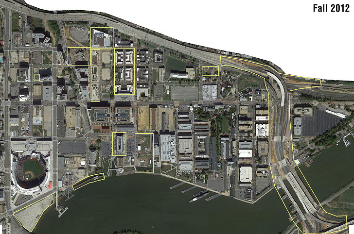 A few weeks ago, Google updated its satellite images of the DC area, including of course Near Southeast.
 It appears to be from early October 2012, perhaps Oct. 13, since there's an event at the Yards Park that could be Snallygaster, plus the postseason signage is on the Nats diamond, and the trash transfer station's final demolition is just underway.
As I've done with each new image since 2002(!), I've posted it on my Images from Above page, where you can choose to display multiple versions going back to 1949(!!) to compare them.
I also always highlight the changes from the previous image, which in this case means the completion of Capitol Quarter's second phase, the Teague-Yards bridge, the Florida Rock site clearing, the 11th Street Bridges construction, and more.
If you want to zoom into the historic images, Google Earth allows you to view archival versions. (For the record, I love the ghostly images of Nats Park under construction in the 2006 shots.)
|
Comments (2)
More posts:
Rearview Mirror
|
(Warning: Navel gazing ahead!)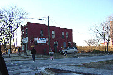 Even in my semi-retired state, I'd like to believe it is still worth noting that Saturday marks the 10-year anniversary of my first real photographic excursion* south of the Southeast Freeway, when on lark on a cold Sunday afternoon I had my husband drive me around while I took some furtive shots with an early generation digital camera.
 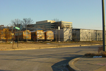 When I took these pictures, the notion of a baseball stadium anywhere in DC, let alone on South Capitol Street, was still thought of as a "maybe someday" dream, not anything that was actually only five years from opening. There was no hulking US Department of Transportation on M Street, and no public access to the entire 55-acre Southeast Federal Center with its long stretch of Anacostia waterfront. There were no parks, though there were school buses! And there were certainly no brightly colored townhouses selling for hundreds of thousands of dollars.
 There were a couple of new office buildings built a few years earlier when NAVSEA moved to the Navy Yard, and one additional one was under construction. There was a banner announcing a coming shiny new apartment building at New Jersey and K, which my husband and I laughed at every time we saw it--who would ever want to live THERE?.
Even in my semi-retired state, I'd like to believe it is still worth noting that Saturday marks the 10-year anniversary of my first real photographic excursion* south of the Southeast Freeway, when on lark on a cold Sunday afternoon I had my husband drive me around while I took some furtive shots with an early generation digital camera. There was no rhyme or reason to the pictures I took, and there certainly was no grand plan that I'd spend the next decade amassing more than 60,000 additional photos** of the changes and events along the path of Near Southeast's redevelopment.
All I knew was that were some plans to redevelop the neighborhood, especially the areas along the water as well as the public housing project a few blocks south of my house. I thought it would be cool to have some "before" photos, especially having watched other areas of the city change so radically from what I had first remembered as a high schooler and then college kid in the 1980s, venturing to the original 9:30 Club or the Tiber Creek Pub. I put a few of them up on my web site (already called JDLand, I'll have you know), mainly so that my dad could see them.
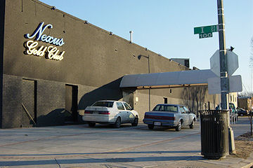
When I took these pictures, the notion of a baseball stadium anywhere in DC, let alone on South Capitol Street, was still thought of as a "maybe someday" dream, not anything that was actually only five years from opening. There was no hulking US Department of Transportation on M Street, and no public access to the entire 55-acre Southeast Federal Center with its long stretch of Anacostia waterfront. There were no parks, though there were school buses! And there were certainly no brightly colored townhouses selling for hundreds of thousands of dollars.There were a couple of new office buildings built a few years earlier when NAVSEA moved to the Navy Yard, and one additional one was under construction. There was a banner announcing a coming shiny new apartment building at New Jersey and K, which my husband and I laughed at every time we saw it--who would ever want to live THERE?. There were a lot of small businesses, a number of carry-outs and market/liquor stores, four gas stations, concrete plants, auto repair garages, warehouses, Metrobuses, and of course nightclubs, gay and straight. And a lot of trash-strewn empty lots.
I look now at the photos from those early years, and it just doesn't seem like it can really have been 10 years. I remember when the boarded up gas station at 3rd and M was demolished in October 2003, thinking "FINALLY!"
I remember working up the courage to go to public meetings, and feeling like a dingbat trying to explain who I was ("yeah, so, I have this web site, and I, like, take pictures and stuff?").
I remember walking around the neighborhood for hours on Sunday mornings in 2006 and 2007, rarely crossing paths with another human.
I remember the exhaustion of the all-details-blogging about the construction and opening of Nationals Park, especially at the end of 2007 and beginning of 2008. I laugh about how my fraidy-cat tendencies were shoved aside while I traipsed around the site in a hard hat (me! in a hard hat!), sometimes climbing rickety ladders, to get to spots where the best pictures would be had.
I think about how it seemed like the documenting of the stadium's birth was the main subject of this site, and yet I realize that I've now written about the neighborhood for almost as long with the stadium open as not.

I imagine I should have some grand What It All Means theory, for the neighborhood, or for "citizen journalism" or "hyperlocal blogging," or my life, or whatever. But, mainly I'm lucky that the stars aligned to have this particular neighborhood undergo such a transformation, in a way that tied in with my history-journalism-photography-web development backgrounds (and my obsessive-compulsiveness).
I do think it's been shown, though, that a project like this isn't as easy to replicate as it might seem (so maybe I did deserve that award!).
I'm also lucky that so many people have helped me along the way, with information, tips, tutorials on commercial real estate development and construction, and zoning, and urban planning, and all the other things I really knew nothing about before I started down this path.
And I'm really lucky that over the years people who have stumbled onto the site have found it interesting, which is what has pushed me to keep going, even if it's in a somewhat less-than-optimal fashion right now. Because, really, all I wanted was some cool pictures to be able to look back on.
Without getting into detail, my pulling back somewhat has definitely been the right thing to do, and the times when I go days or even weeks without posting aren't really just me being lazy. But the funny thing is, I still research and track all the minutiae the same way--it's just that final step of writing it out that I can't always get through.
I think, though, that 2013 is going to have a lot of the "milestones" that still propel me to post--restaurants will open, other retail may come along, and maybe some buildings will get started. And there still will be pictures to be taken. Because, even if I wanted to, I don't think I could ever really stop watching the neighborhood change, and if I'm going to watch it, and photograph it, I might as well keep blabbing on about it, and might as well share it with anyone still interested.
So go look at the pictures from January 19, 2003 (and all the others that I've put online), since that's what this was really all about. And accept my deep appreciation for being along for the ride.
*I say "real excursion", and date the blog's anniversary to Jan. 19, 2003, because that was the first time I took photos and then put them on the web, and really began this life-consuming project. But I need to note that I did also take some photos of the neighborhood back in the fall of 2000, during the reconstruction of M Street and the Navy Yard's renovation for NAVSEA, with my old film camera--but I forgot about them and didn't even develop the film until sometime in 2004 (hence the rotten quality!).
**Only about one third of the photos I've taken are actually on the web site, by the way.
|
Comments (7)
More posts:
Rearview Mirror, JDLand stuff
|
Today is the five-year anniversary of one of my most favorite JDLand-related days ever, a gorgeous end-of-summer day when I got to traipse into all corners of Nationals Park, which was at that point just under seven months away from opening. Everyone was still concerned about whether it would open on time, but I spent most of my time marveling at the progress in comparison to what had stood there less than 18 months earlier--and being wowed by my first visits to the viewing platform above Potomac Avenue and all the other views looking out at the surroundings from the upper decks.
Back in this era, I wasn't doing single-page photo galleries on days like this, so I tossed together this new gallery of the best shots of the day. It's interesting to think about everything that's changed in only five years--not only the field itself, but the team on the field, and everything surrounding it.


|
Comments (0)
More posts:
photos, Rearview Mirror, Nationals Park
|