
|
| |||||||||||||||||||


|
Please note that JDLand is no longer being updated.
peek >>
Near Southeast DC Past News Items: Sep 30, 2010
- Full Neighborhood Development MapThere's a lot more than just the projects listed here. See the complete map of completed, underway, and proposed projects all across the neighborhood.
- What's New This YearA quick look at what's arrived or been announced since the end of the 2018 baseball season.
- Food Options, Now and Coming SoonThere's now plenty of food options in the neighborhood. Click to see what's here, and what's coming.
![-]()
- Anacostia RiverwalkA bridge between Teague and Yards Parks is part of the planned 20-mile Anacostia Riverwalk multi-use trail along the east and west banks of the Anacostia River.
![-]()
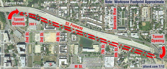
- Virginia Ave. Tunnel ExpansionConstruction underway in 2015 to expand the 106-year-old tunnel to allow for a second track and double-height cars. Expected completion 2018.
![-]()
- Rail and Bus Times
Get real time data for the Navy Yard subway, Circulator, Bikeshare, and bus lines, plus additional transit information. - Rail and Bus Times
Get real time data for the Navy Yard subway, Circulator, Bikeshare, and bus lines, plus additional transit information. - Canal ParkThree-block park on the site of the old Washington Canal. Construction begun in spring 2011, opened Nov. 16, 2012.
![-]()
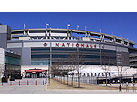
- Nationals Park21-acre site, 41,000-seat ballpark, construction begun May 2006, Opening Day March 30, 2008.
![-]()
- Washington Navy YardHeadquarters of the Naval District Washington, established in 1799.
![-]()
- Yards Park5.5-acre park on the banks of the Anacostia. First phase completed September 2010.
![-]()
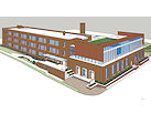
- Van Ness Elementary SchoolDC Public School, closed in 2006, but reopening in stages beginning in 2015.
![-]()
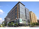
- Agora/Whole Foods336-unit apartment building at 800 New Jersey Ave., SE. Construction begun June 2014, move-ins underway early 2018. Whole Foods expected to open in late 2018.
![-]()
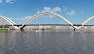
- New Douglass BridgeConstruction underway in early 2018 on the replacement for the current South Capitol Street Bridge. Completion expected in 2021.
![-]()
- 1221 Van290-unit residential building with 26,000 sf retail. Underway late 2015, completed early 2018.
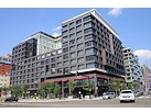
- NAB HQ/AvidianNew headquarters for National Association of Broadcasters, along with a 163-unit condo building. Construction underway early 2017.
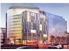
- Yards/Parcel O Residential ProjectsThe Bower, a 138-unit condo building by PN Hoffman, and The Guild, a 190-unit rental building by Forest City on the southeast corner of 4th and Tingey. Underway fall 2016, delivery 2018.
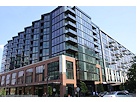
- New DC Water HQA wrap-around six-story addition to the existing O Street Pumping Station. Construction underway in 2016, with completion in 2018.
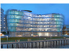
- The Harlow/Square 769N AptsMixed-income rental building with 176 units, including 36 public housing units. Underway early 2017, delivery 2019.
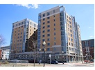
- West Half Residential420-unit project with 65,000 sf retail. Construction underway spring 2017.
![-]()
- Novel South Capitol/2 I St.530ish-unit apartment building in two phases, on old McDonald's site. Construction underway early 2017, completed summer 2019.
![Novel South Capitol]()
- 1250 Half/Envy310 rental units at 1250, 123 condos at Envy, 60,000 square feet of retail. Underway spring 2017.
![-]()
- Parc Riverside Phase II314ish-unit residential building at 1010 Half St., SE, by Toll Bros. Construction underway summer 2017.
![-]()
- 99 M StreetA 224,000-square-foot office building by Skanska for the corner of 1st and M. Underway fall 2015, substantially complete summer 2018. Circa and an unnamed sibling restaurant announced tenants.
![-]()
- The Garrett375-unit rental building at 2nd and I with 13,000 sq ft retail. Construction underway late fall 2017.
![-]()
- Yards/The Estate Apts. and Thompson Hotel270-unit rental building and 227-room Thompson Hotel, with 20,000 sq ft retail total. Construction underway fall 2017.
![-]()
- Meridian on First275-unit residential building, by Paradigm. Construction underway early 2018.
![-]()
- The Maren/71 Potomac264-unit residential building with 12,500 sq ft retail, underway spring 2018. Phase 2 of RiverFront on the Anacostia development.
![-]()
- DC Crossing/Square 696Block bought in 2016 by Tishman Speyer, with plans for 800 apartment units and 44,000 square feet of retail in two phases. Digging underway April 2018.
![DC Crossing]()
- One Hill South Phase 2300ish-unit unnamed sibling building at South Capitol and I. Work underway summer 2018.
![One Hill South Phase 2]()
- New DDOT HQ/250 MNew headquarters for the District Department of Transportation. Underway early 2019.
![New DDOT HQ]()
- 37 L Street Condos11-story, 74-unit condo building west of Half St. Underway early 2019.
![37 L Condos]()
- CSX East Residential/Hotel225ish-unit AC Marriott and two residential buildings planned. Digging underway late summer 2019.
![CSX East Residential/Hotel]()
- 1000 South Capitol Residential224-unit apartment building by Lerner. Underway fall 2019.
![1000 South Capitol Residential]()
- Capper Seniors 2.0Reconstruction of the 160-unit building for low-income seniors that was destroyed by fire in 2018.
![1000 South Capitol Residential]()
- Chemonics HQNew 285,000-sq-ft office building with 14,000 sq ft of retail. Expected delivery 2021.
![1000 South Capitol Residential]()



2 Blog Posts
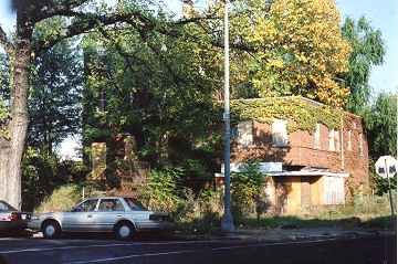
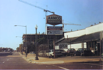
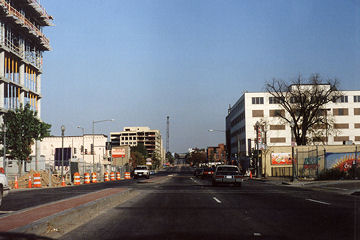 While I officially date the start of my blogging about Near Southeast as being January 2003, that was not when I took my first photos around the neighborhood. In the early fall of 2000, I grabbed a camera (a FILM camera!) and drove south of the freeway, around the neighborhood whose name I didn't know, to take some pictures. I had no plan to do anything with them; in fact, the prints quickly got filed away and I didn't even remember having them until I stumbled across them in 2004. The film I used was bad, so many of the shots barely came out. I don't even know exactly what day it was--judging by the color of the trees, it could be late September or early October. But, despite all of that, the 24 photos I took, now 10 years ago, mark the beginning of my very strange and unexpected odyssey.
 I had spent almost no time below the freeway since buying our house on the south side of Capitol Hill in 1995 (the area's reputation and lack of any amenities gave us no reason to). But in 1999 and 2000, the 3rd Street on-ramp for the freeway was being rebuilt, which forced us to drive to South Capitol Street to get on the westbound freeway. We usually crossed over on K Street to New Jersey, and often got a good laugh when we'd see a sign draped on the southeast corner of the intersection touting a new multiunit residential building "steps from the Capitol." "Dear God, who would ever pay big bucks to live down HERE?" I remember saying to Mr. JDLand on more than one occasion. (So much for vision.)
 But I was still aware of the changes that were being talked about for the area, along with the first mini-building boom already underway: the construction was almost finished at the Navy Yard to house the NAVSEA operations, and we could see 80 M and 300 M rising up as we drove on the freeway, and I even remember being aware of the streetscape improvements being made to M Street (curbs, bricked medians and crosswalks). So I took a bunch of photos, and promptly forgot about them. And then started the tracking for real in early 2003, this time with a digital camera in hand.
Even though the pictures are pretty cruddy, they're still worth wandering through. Try not to look at the locations, and see if you can figure out where they are; then click on the  icon to see what's happened to these spots in the intervening decade.
icon to see what's happened to these spots in the intervening decade.|
Comments (0)
More posts:
Rearview Mirror, JDLand stuff
|
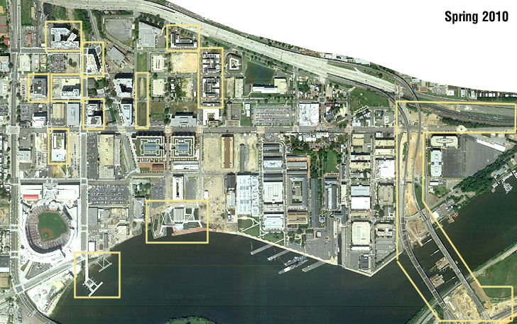 GGW sent out the alert this morning that Google has updated its satellite images of DC, giving us the first overhead images of Near Southeast since Spring 2008. I've added this (somewhat washed out) view to my Satellite Images page, where you can compare it to images from Google and other sources from 1949 (!), 1988, 2002, 2004, 2005, 2006, and 2008. (But you'll also want to visit Google Maps to be able to zoom in on the latest image to get a better view.) Considering that the 2008-10 time frame will be looked back on as the era of the Economic Downtown, there are still plenty of changes to see, including the first phase of Capitol Quarter, the Yards Park and Diamond Teague Park, the construction of the new 11th Street Bridges, and the completion of a number of office and residential buildings north of Nationals Park. (The stadium looks kind of cool from on high as well.) And the lack of schoolbuses at Canal Park!
|
Comments (0)
More posts:
Rearview Mirror, JDLand stuff
|

